Why John o’Groats deserves a stop on the NC500
Well, let’s be honest: if you look at John o’Groats on the map before you go, there are two schools of thought. The first says, “it’s just a tourist sign at the end of the road, we can skip it.” The second says, “no, no, it’s THE iconic point of northern Scotland, we have to go.” We were somewhere in between when we arrived. We left firmly in the second camp, without hesitation.
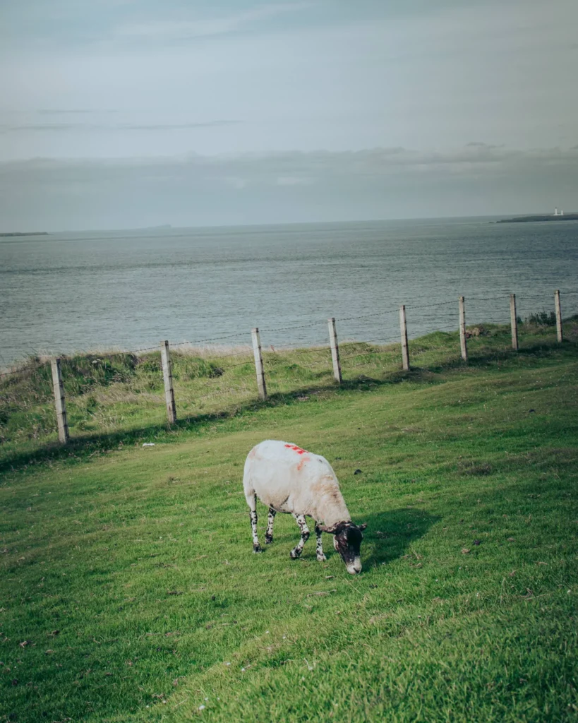
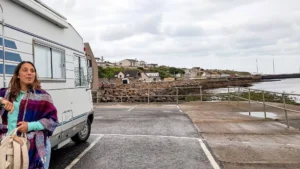
In practical terms, John o’Groats is the north-east tip of mainland Britain, just 20 minutes by campervan north of Wick, in the Caithness district. It’s the visible and famous end of the mythical challenge “Land’s End to John o’Groats” (the LEJoG, 1407 km from Cornwall to here, done on foot, by bike, or even on horseback by the most adventurous). It’s the sign that we photograph. But it’s also the raw scenery around that saves the stop from being too touristy: the rocky pinnacles of Duncansby Head just 4 km to the east, the isolated white lighthouse on the cliff, the sheep grazing without a care two meters from the edge, and that northern light that looks like nothing else.
Our personal stop was right after visiting the Old Pulteney distillery in Wick, which we did that very morning (detailed in our Wick article). We continued the NC500 route full north with a bottle of 12 Years Old freshly bought in the van. And we ended up enjoying it that very evening at the most isolated campsite we had during the trip. If you’re reading this guide to decide if the stop is worth it, the short answer is yes, but not for the right reasons (the sign doesn’t make the experience, it’s what’s around it).
John o’Groats in brief: Vikings, Jan de Groot, and “end of the world” comparable to Sagres
A bit of context to place the location, because without it, the stop just looks like a parking lot facing a sign. John o’Groats is named after Jan de Groot, a Dutch ferryman who settled here in the late 15th century (around 1496, under James IV of Scotland) to operate the crossing to the Orkney Islands. The fare at the time to cross the strait was a “groat”, a Scottish coin worth 4 pence, hence the name “John o’Groats” which has been distorted over the centuries. A nice linguistic anecdote to slip into a conversation at the pub.
Geographically, we are in the Caithness district, this area far north-east of mainland Scotland that owes its identity to the Vikings (the name Caithness comes from the Gaelic Gallaibh, “the land of the foreigners,” referring to the Norse settlers who arrived here in the 9th century). Across the strait, 11 km north via the Pentland Firth, lies the now uninhabited island of Stroma, and then the Orkneys (Orkney) whose outlines can be seen on clear days. The Pentland Firth is one of the strongest tidal currents in the world, which is why the ferries that cross don’t joke around with their schedules.
Our arrival feeling: we had exactly the same impression as at Sagres, at the south-west tip of Portugal, a few months earlier on this same road trip (yes, it’s a bit long, this road trip). The feeling of being at the edge of a continent, having pushed one last door before the sea. With a notable climatic difference: it was colder at John o’Groats in the middle of August than at Sagres in the middle of winter, where we were in shorts and t-shirts. Welcome to the Scottish nuance.
Our experience at John o’Groats: sheep, Duncansby Head, and whisky camping
Well, let’s say it right away, John o’Groats isn’t really the village that stands out. It’s the day around it. Here’s how it went for us.
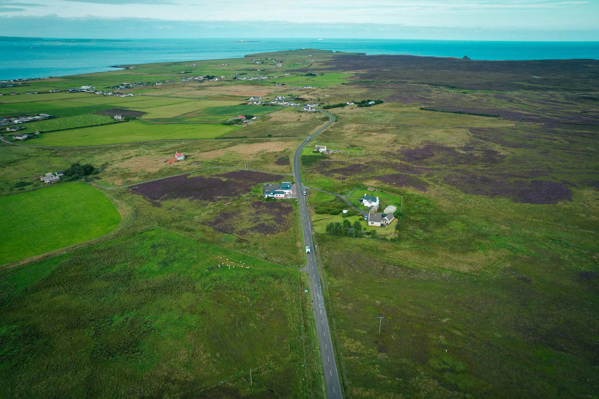
The NC500 road north from Wick (and the elf sheep)
We leave Wick in the morning after the Old Pulteney visit, with a bottle of 12 Years Old secured in the back of Edward (our Hymer). The sky cleared up, beautiful light on the east coast. The road climbs via the A99 which gradually becomes smaller, more deserted, dotted with ruined castles that flank the coast (Castle of Old Wick south of Wick, then further on the chain of medieval towers in silhouette). The sheep cross calmly in the middle of the road, without looking, without rushing. We brake gently, pass, and continue.
And then there it is, by the side of the road, we come across a sheep with big ears. We stop, photo. Caroline immediately names it “the elf sheep” (yes, it’s silly, yes it made us laugh for miles, we own it). Probably a North Country Cheviot or a Highland, the two dominant breeds in Caithness that indeed have more pronounced ears than average. The nickname stuck for the rest of the stay.
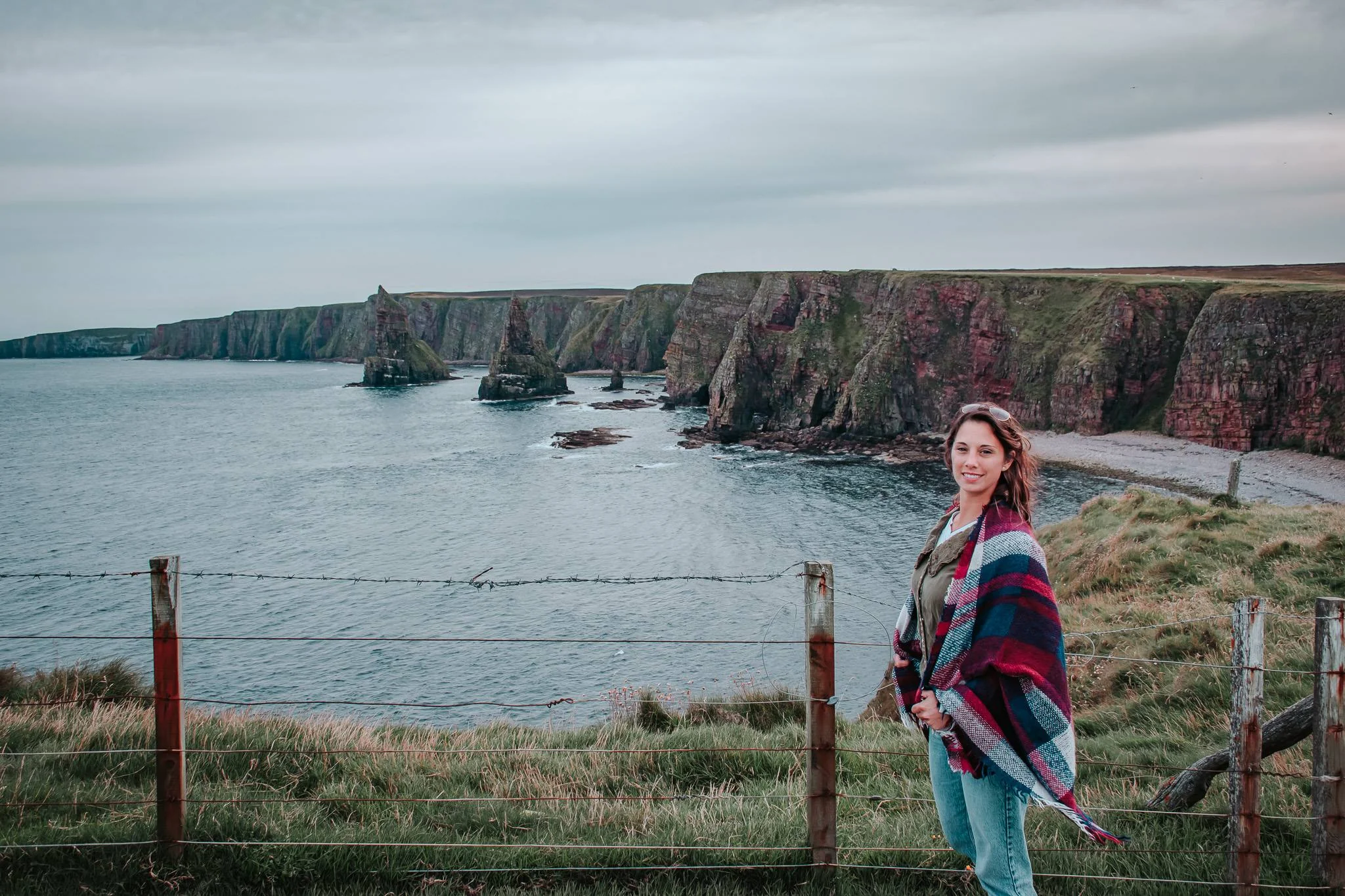
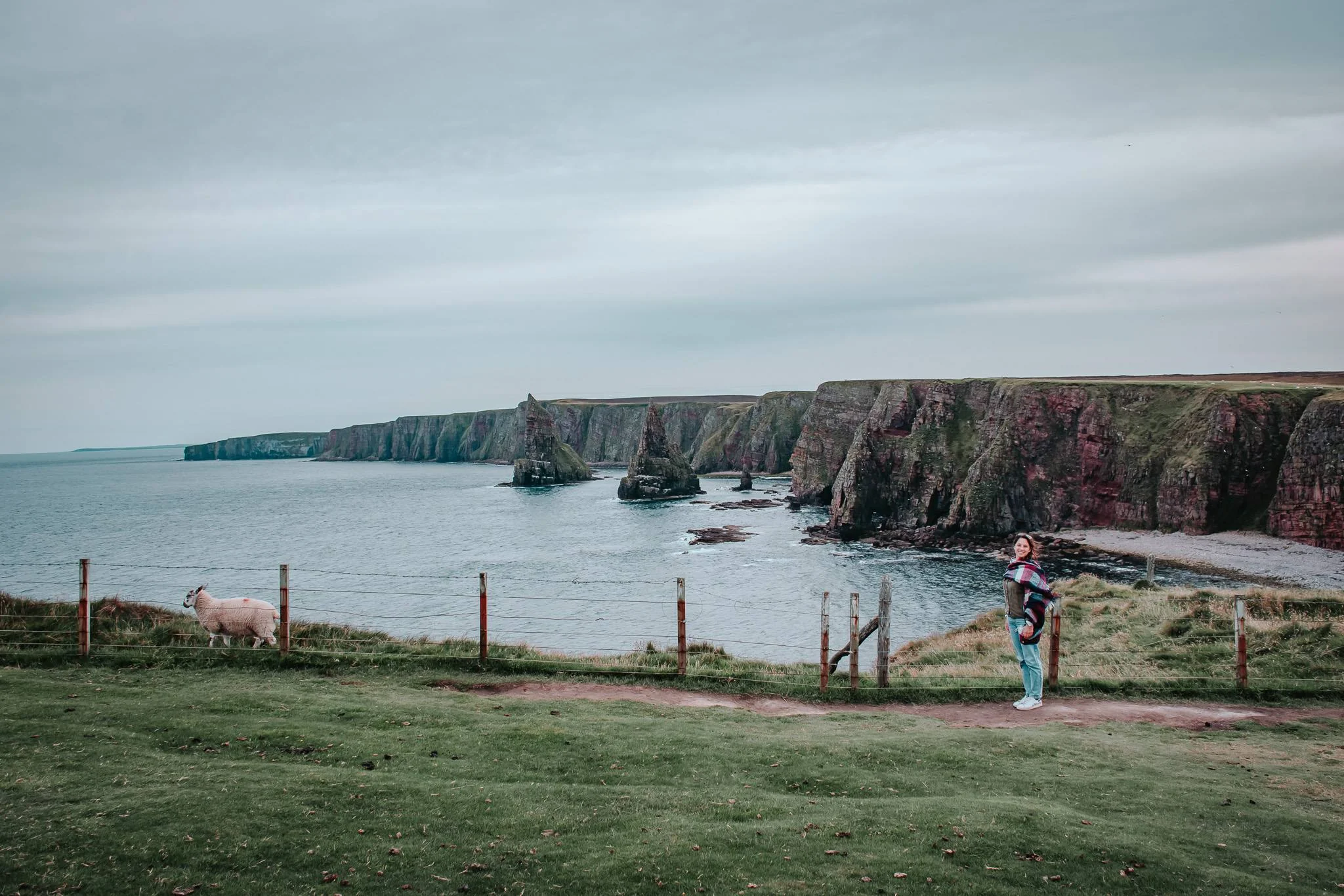
Duncansby Head and its atypical rocky pinnacles
Arriving at the John o’Groats sign: we check the box, obligatory photo, knowing smile with Caroline (and let’s be honest: it’s still just a sign, we’re not discovering Petra). The thing you absolutely must do in addition, and that many miss, is to push 4 km further east to the Duncansby Head lighthouse, free parking, and walk 30 minutes along the path that runs along the cliffs to the south.
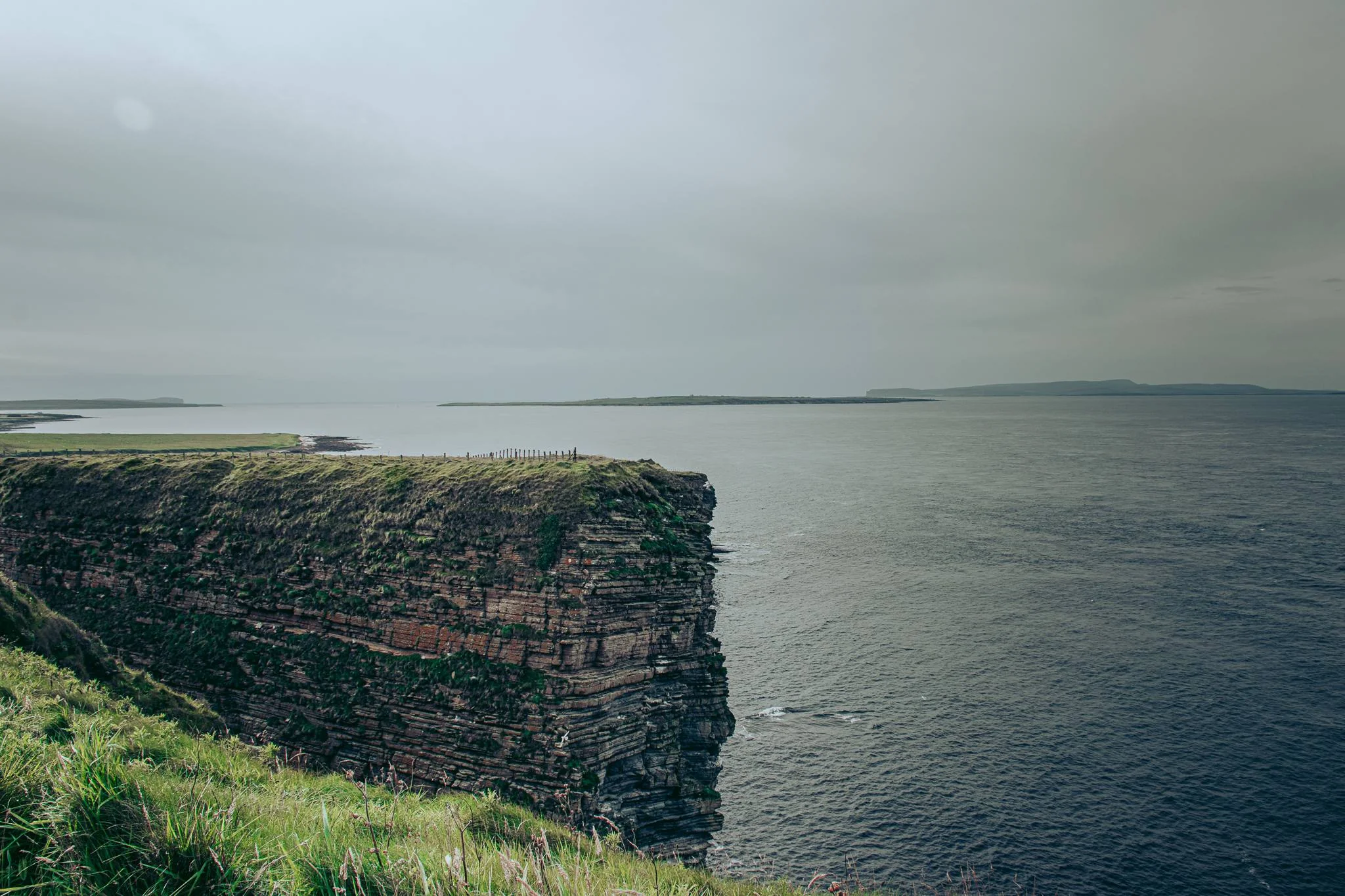
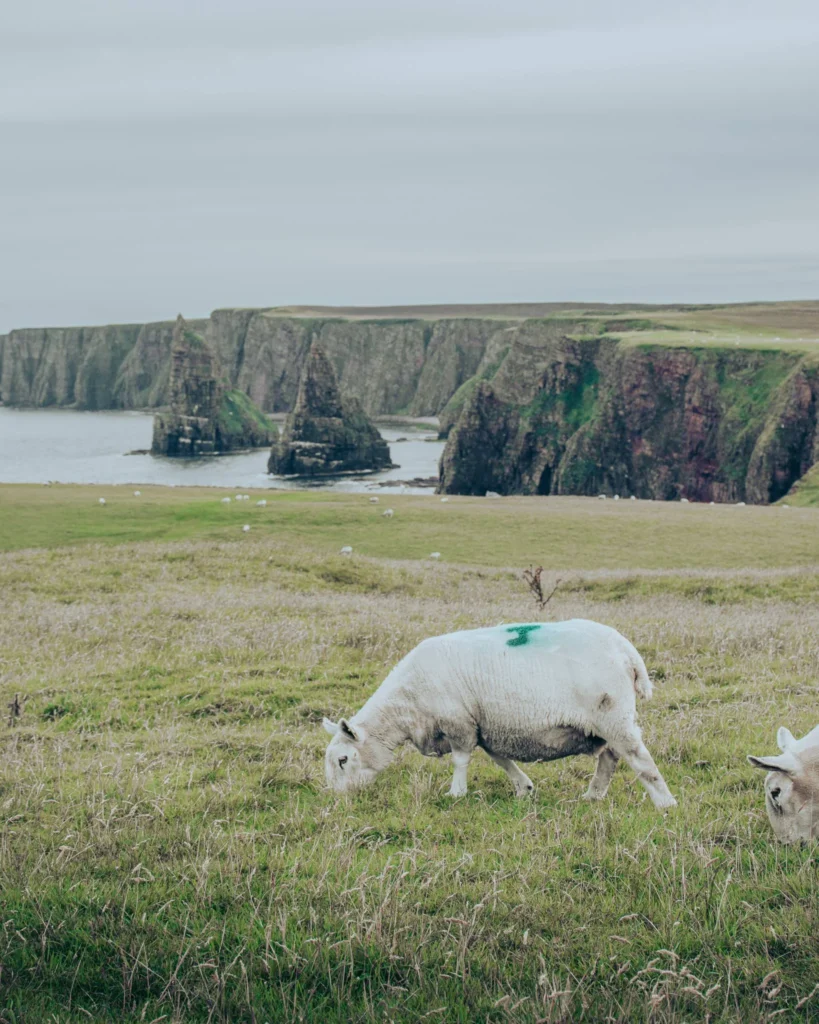
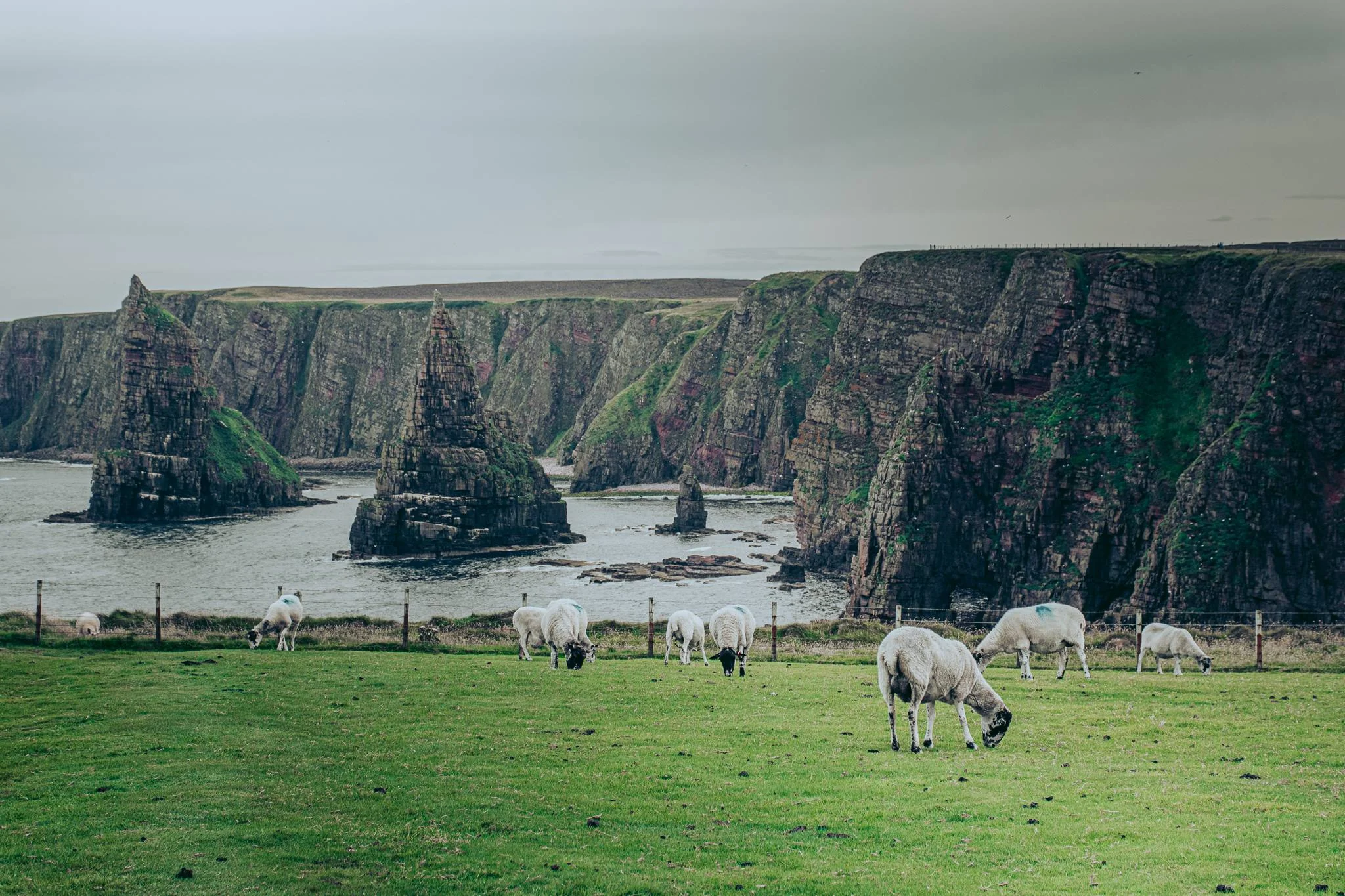
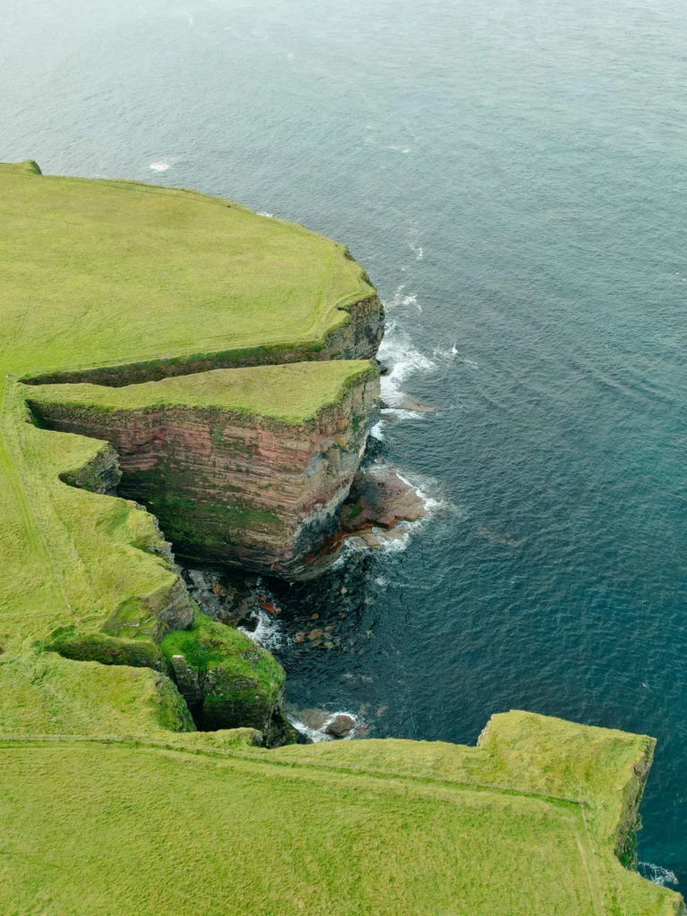
And then, the scenery changes completely. We discover the Duncansby Stacks, three rocky needles rising just offshore, with unusual shapes and the North Sea in the background. It’s the iconic image of the northeast tip of Scotland, much more than the sign itself. And the magical thing is that when turning to face the sea, we get the full spectacle: steep cliffs dropping 60 meters below, rocky pinnacles offshore, and in the distance, the silhouette of the Orkneys emerging.
A raw and fresh landscape, far from the Dubai or Ibiza style, that captures you in the middle of August and simply reminds you of “the beauty of the planet” (yes, I know I’m listening to myself). The wind is often strong at the tip: be sure to bring a windbreaker or waterproof even in summer; we are not in the Cyclades.
The post-JoG bivouac: whisky facing the islands and a sheep neighbor
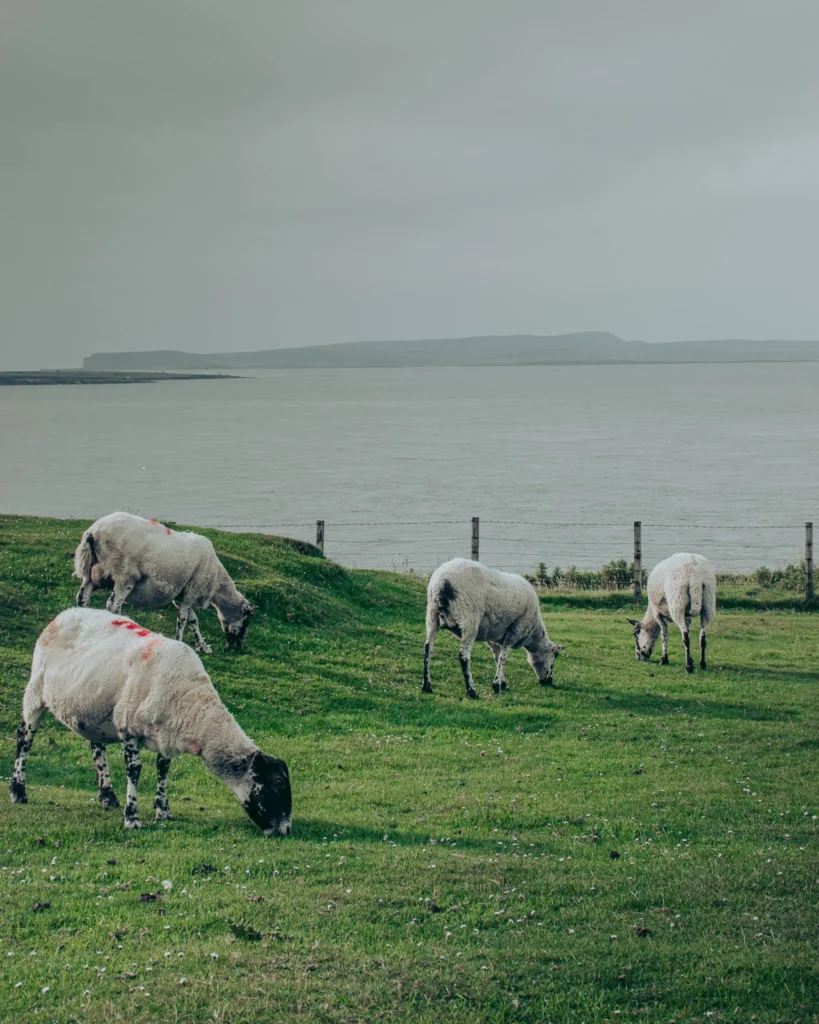
And then the day comes to an end. Hunger, fatigue, but no desire to wrap it up by stopping just anywhere. We hit the road a bit west along the north coast, looking for a spot. And there, jackpot: on the edge of a very quiet road, totally isolated in the Highlands, with the North Sea as a backdrop, a view of the islands (probably Stroma and the Pentland Skerries, maybe the Orkneys on a clear day). We park Edward parallel to the sea. We open the bay window. We watch.
The only potential nighttime neighbor: a sheep, grazing 20 meters away and completely ignoring us. That’s exactly what we wanted. We take out the 12 Years Old bottle of Old Pulteney brought back from the distillery that morning, pour two glasses, and enjoy a maritime Scottish whisky at the end of Scotland, facing the North Sea. Without spending anything more than the whisky we had already paid for.
An excellent night of sleep in complete tranquility. In the morning, against all weather forecasts predicting rain for the whole week, we wake up under a radiant sun. The wind is still strong, but the sky is blue, and energy returns. One of those mornings that remind you why you go camping: the window opens, the scenery changes everything, and we didn’t pay anyone for that.
Heading west again: Highland cows in total freedom
We hit the road heading west to follow the NC500 along the north coast. And that’s when the unforgettable moment arrives. On the side of the road, about ten Highland cows in total freedom, without enclosures. Reddish and orange coats, bangs in front of their eyes, long horns. Magnificent, curious, and surprisingly docile. They approach very close to the campervan when we cut the engine. Caroline gently steps out, takes the photos that are among the most beautiful of the trip. We stay there for 20 minutes watching them, without moving. Exactly the kind of moment we were looking for when coming to Scotland, and one that you can’t plan; it happens or it doesn’t, depending on luck.
A little cultural nod for the 40+: the scenery of sea + sky + bright green grass + black cows + white sheep all together directly reminds you of the landscapes from the Highlander series filmed in this region of the Highlands in the 1980s. Not just a vague resemblance, really the same scenery. A slightly unreal spectacle to close the morning.
What to see and do at John o’Groats (the 5 must-sees)
Here’s what you should do when passing through John o’Groats, from the most iconic to the more hidden gems.
The iconic John o’Groats sign (and the Land’s End marker)
The emblematic sign, planted at the edge of the harbor, indicates the distances to major British destinations: Land’s End 874 miles (1407 km, the southernmost point of Great Britain, in Cornwall), New York 2200 miles, Edinburgh 270 miles. A must-take photo, it’s the local ritual. On the sign, you can also add your own personalized destination (since 2014, an activity from the tourist info shop right next door for a few pounds). Handy for a souvenir.
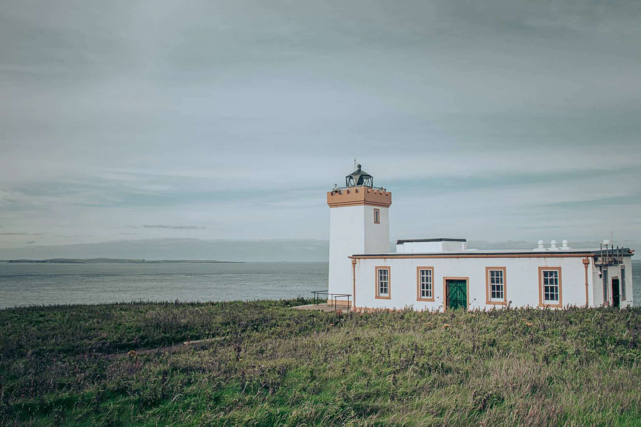
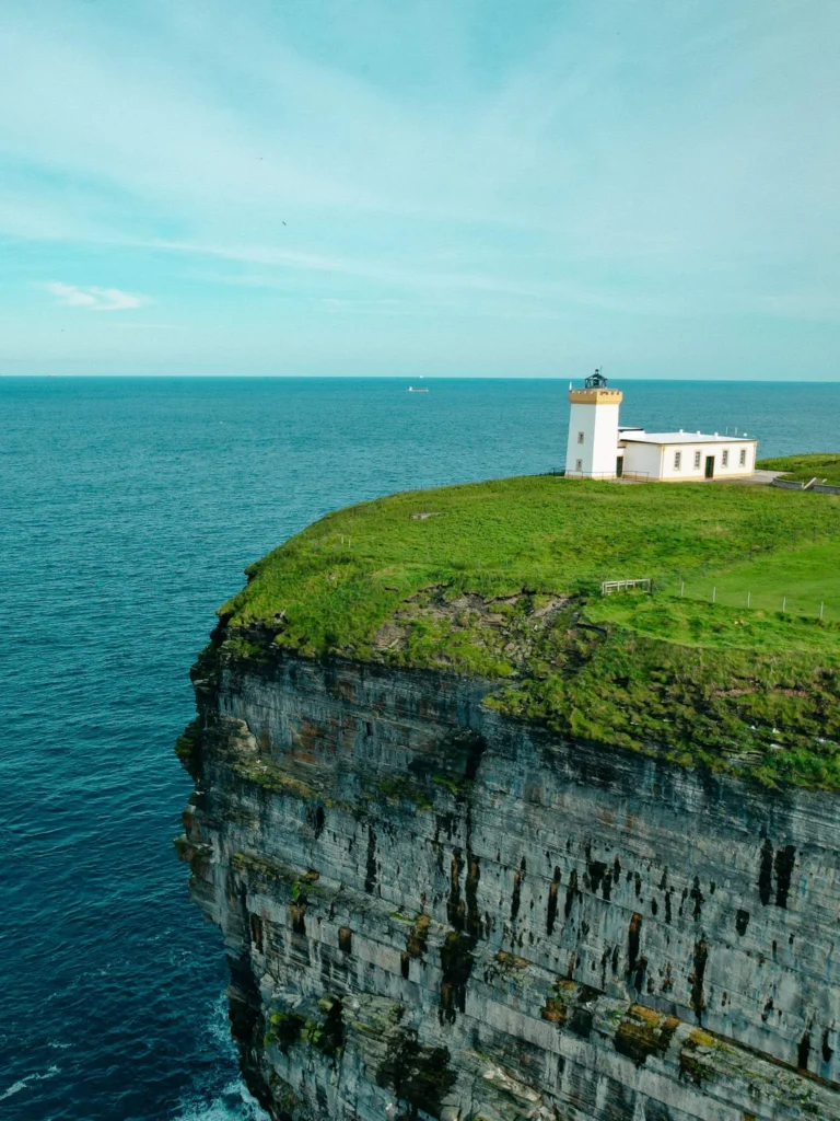
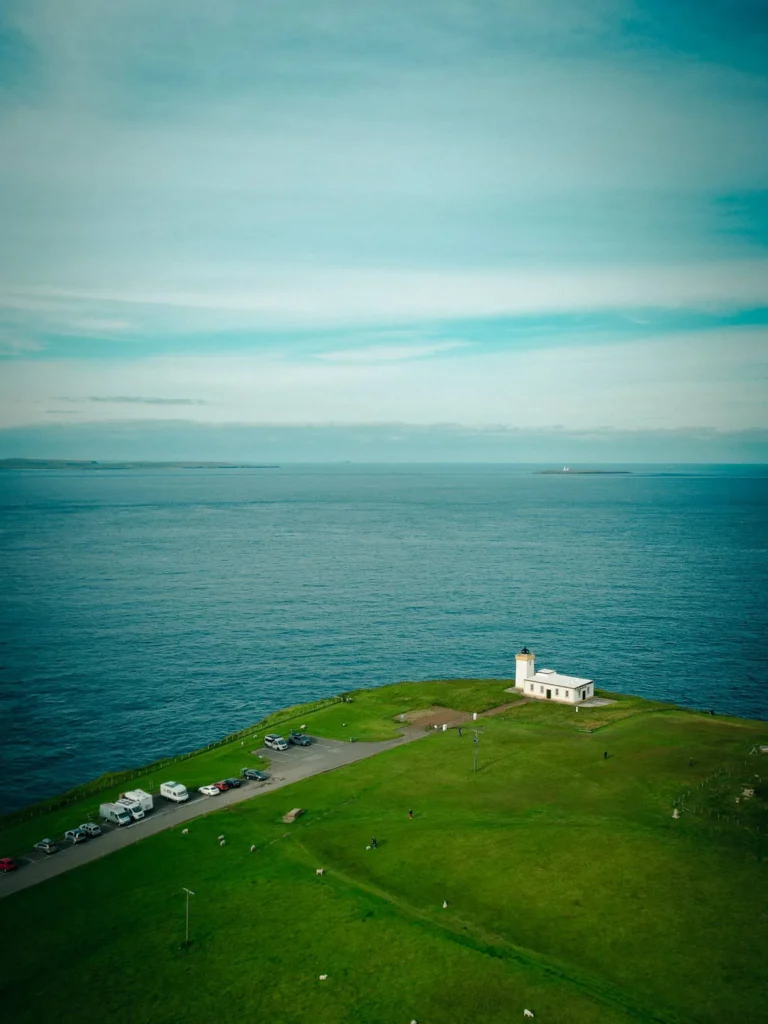
Duncansby Head, its white lighthouse and the rocky pinnacles
4 km east of the village, the white lighthouse at Duncansby Head (built in 1924, automated in 1997) officially marks the true northeast point of mainland Britain. Free parking at the foot of the lighthouse. From there, a marked path of 30 minutes round trip south leads to the viewpoint overlooking the Duncansby Stacks (the three rocky pinnacles). Spectacular 360° view, 60-meter cliffs, colonies of seabirds (puffins in season, fulmars, petrels). A must-do, even in gray weather.
The port of John o’Groats and the ferry to the Orkneys
The port of John o’Groats is the departure point for the John o’Groats Ferries that cross to the Orkneys during the summer season (May to September, 40-minute crossing to Burwick on South Ronaldsay, about £22 one way in high season). A more regular alternative year-round: the Pentland Ferries departing from Gills Bay 5 km to the west (to St Margaret’s Hope, 1-hour crossing, more stable in terms of prices and frequency). If you want to complete your Scottish road trip with the Orkneys, this is where you take to the sea.
The Last House Museum and local shops
The Last House, right next to the sign, is the former northernmost house in Great Britain, now transformed into a small free museum that traces the history of John o’Groats and Jan de Groot. Nice to understand the context before heading out. Right next door, The Storehouse houses a few local shops (crafts, fresh products, souvenirs) and remains the essential shopping stop at the tip.
Meeting Highland cows and free-roaming sheep
This is not a specific site on a map; it’s a chance to seize at the roadside, but it’s so characteristic of the area that it deserves mention. On the north coast (A836) between John o’Groats and Tongue, several herds of Highland cows graze in free pasture. If you come across them, stop, cut the engine, and step out gently. They are curious but imposing (700 to 800 kg for an adult cow), do not feed them, do not touch them, just watch and photograph from a distance. A memorable souvenir guaranteed.
Excursions and spots in Caithness from John o’Groats
John o’Groats makes an excellent half-day to full-day base for exploring the northeast tip. Here are the classic detours.
Dunnet Head: the true northernmost point (25 km west)
At 25 km west of John o’Groats, Dunnet Head is the true northernmost point of mainland Britain. Lighthouse built in 1831 by Robert Stevenson (the grandfather of Robert Louis Stevenson, yes, the one from Treasure Island). Cliffs even more impressive than at Duncansby, much less crowded, panoramic view of all the Orkneys on a clear day. If you are the purist type wanting the real point, this is it.
Castle of Mey (16 km west, Queen Mum’s residence)
At 16 km west on the A836, Castle of Mey is the former summer residence of the Queen Mother (the mother of Queen Elizabeth II, who acquired it in 1952 and regularly stayed there until her death in 2002). Castle + gardens open to the public from April to September. Very interesting interior visit to understand British royal daily life, access to the vegetable gardens and park. Expect to pay £15 to £20 for the full visit. For fans of royal history or architecture, it’s a worthwhile stop.
Wick and the Old Pulteney distillery (20 minutes south)
At 20 minutes by car south, Wick, the former administrative capital of the Caithness district, is the neighboring must-stop. People come for the Old Pulteney distillery (“The Maritime Malt”, 1826), for Ebenezer Place (the shortest street in the world according to Guinness, 2 m 06), and to radiate towards Castle Sinclair Girnigoe and Whaligoe Steps. Full details in our Wick guide article.
Gills Bay and the alternative ferry to the Orkneys
At 5 km west of John o’Groats, Gills Bay is the departure port for the Pentland Ferries ferry to St Margaret’s Hope (South Ronaldsay, Orkneys). One-hour crossing, more frequent than JoG Ferries (up to 3 rotations per day in high season), fares around £20 for a one-way pedestrian ticket. More convenient if you really want to spend several days in the archipelago.
Castle Sinclair Girnigoe (Wick side, 25 km south)
At 25 km south of John o’Groats, at Noss Head near Wick, the spectacular ruins of Castle Sinclair Girnigoe, an ancient fortress of the Earls of Caithness perched on a rocky promontory. Free access, free parking + 10-minute trail. Iconic photo of Caithness, not to be missed if you are heading back towards Wick.
The interactive map: all our POIs in John o’Groats and around
To visualize all the spots we’ve just mentioned (campsites, service areas, restaurants, iconic sign, Duncansby lighthouse, rock pinnacles, Dunnet Head, Castle of Mey, ferry to the Orkneys), our interactive map below. Click on each marker for details (address, rating, description).
Highland : Places we can tell you about
Here's our selection of places in Highland: spots we've visited that might be useful to you. Use the list view to discover each address in detail, and export everything to add to Google Maps or your favorite GPS app.
| Place | Address | Download |
|---|---|---|
| Dunnet Bay Camping | Dunnet, Thurso KW14 8XP, Royaume-Uni | |
| Wick Caravan Site | Riverside Dr, Wick KW1 5SP, Royaume-Uni | |
| John O'Groats Caravan and Camping Site | John o' Groats, Wick KW1 4YR, Royaume-Uni | |
| Castletown Caravan Park | Castletown, Thurso KW14 8TP, Royaume-Uni | |
| Thurso Bay Caravan & Camping Park | Scrabster Rd, Thurso KW14 7UP, Royaume-Uni |
| Place | Address | Download |
|---|---|---|
| The Storehouse | John o' Groats, Wick KW1 4YR, Royaume-Uni | |
| Flavours | John o' Groats, Wick KW1 4YR, Royaume-Uni | |
| Northern Sands Hotel | Dunnet, Thurso KW14 8XD, Royaume-Uni | |
| The Cottage Tearoom | John o' Groats, Wick KW1 4YR, Royaume-Uni | |
| Seaview Hotel | John o' Groats, Wick KW1 4YR, Royaume-Uni |
| Place | Address | Download |
|---|---|---|
| Duncansby Head Lighthouse | Duncansby Head, Wick, Royaume-Uni | |
| John o' Groats sign | John o' Groats, Wick KW1 4YR, Royaume-Uni |
| Place | Address | Download |
|---|---|---|
| John o' Groats Port | John o' Groats, Wick, Royaume-Uni |
Where to sleep in John o’Groats in a van or motorhome
Several options depending on your style and pace:
John O’Groats Caravan and Camping Site: THE official campsite at the tip, ideally located in the heart of the village and 50 m from the iconic sign. Full services (water, drainage, electricity, sanitation). Expect to pay £20 to £30 per night depending on services. Ideal for a practical overnight stay on site.
Dunnet Bay Caravan Park (Dunnet, 25 km west): campsite with stunning views of Dunnet Bay, golden sandy beach right next door. Quieter than JoG village, more nature-oriented atmosphere.
Castletown Caravan Park (Castletown, on the north coast): peaceful park in a charming small village, perfect base for exploring.
Thurso Bay Caravan & Camping Park (Thurso, 30 km west): campsite with direct access to the beach. The nearest large town for supplies.
Wick Caravan Site (Riverside Drive, Wick): alternative on the south side, known for its cleanliness and hospitality. 20 minutes from JoG.
Wild camping: we did our wild camping on the northwest coast of JoG, on a very quiet road facing the sea. Allowed in certain areas of the NC500, provided you respect the “leave no trace” code (no fires, no litter, leave at the slightest sign of disturbance). Check the signage on site + the Park4Night app before settling down. The parking lot at Duncansby Head lighthouse is sometimes mentioned, check the night signs.
Seaview Hotel: historic hotel in the heart of John o’Groats village, restaurant open. Rooms around £90 to £140 per night depending on the season.
Natural Retreats John O’Groats: a collection of designer lodges by the sea, right next to the iconic sign. Very successful modern architecture that enhances the site (designed by GLM Architects, award-winning). More expensive, expect £150 to £250 per night depending on configuration.
Northern Sands Hotel (Dunnet, 25 km west): warm option on the Dunnet Bay side, locally recognized seafood cuisine.
Castle of Mey accommodations: if you really want to sleep near the Queen Mum’s castle, several restored cottages and farms are available on the estate.
What budget to plan for John o’Groats on a road trip
API RapidAPI Cost of Living indisponible (HTTP 520 — timeout origin Cloudflare). Le service est en panne, réessayez plus tard.
To situate concretely:
- Pub meal / fish and chips in JoG village: £10 to £15 per person;
- Restaurant meal (Seaview Hotel, Storehouse, Cottage Tearoom): £20 to £35 per person with a drink;
- Last House Museum: free;
- Duncansby Head + rock pinnacles: free, free parking;
- Castle of Mey visit: £15 to £20 per adult;
- Ferry to the Orkneys: £22 to £30 per adult one-way depending on departure (JoG Ferries shorter or Gills Bay more regular);
- Motorhome parking: £20 to £30 at John O’Groats Caravan Site with services, £0 for tolerated wild camping on the north coast.
Count on £60 to £100 per day for two in vanlife in John o’Groats (meals + 1 paid activity + camping or wild camping), to be adjusted according to your choices. We managed around £40 that day: free wild camping, meals in the van, just a little something to nibble at the Storehouse to support local business.
What climate and season to visit John o’Groats
Highland : a glimpse of the weather
5-day forecast
Planning an unexpected departure? Check out the weekly weather before packing your bags.
Monthly climate
Weather-wise, our heart leans towards bright sunshine. That said, you might have different criteria for choosing when to visit.
| Month | Min temp | Max temp | Rain | Weather | Rating |
|---|---|---|---|---|---|
| June | 10°C | 15°C | 158 mm | 🌧️ | |
| July | 13°C | 17°C | 77 mm | 🌧️ | |
| August | 12°C | 17°C | 116 mm | 🌦️ | |
| September | 11°C | 15°C | 67 mm | 🌦️ | |
| October | 9°C | 13°C | 138 mm | 🌧️ | |
| November | 5°C | 9°C | 107 mm | 🌧️ | |
| December | 5°C | 9°C | 60 mm | 🌦️ | |
| January | 2°C | 5°C | 116 mm | 🌧️ | |
| February | 3°C | 6°C | 89 mm | 🌧️ | |
| March | 4°C | 10°C | 58 mm | 🌧️ | |
| April | 5°C | 11°C | 88 mm | 🌧️ | |
| May | 7°C | 12°C | 101 mm | 🌧️ |
For the season: June to August are the most stable months, with temperatures between 11 and 16°C during the day, very long days (in June, the sun hardly sets around midnight). Almost permanent wind is the signature of the area, so plan for a fleece + windbreaker even in mid-summer. September remains possible with beautiful autumn colors, fewer people at Duncansby Head. Avoid November to March: strong winds, very short days, many shops closed, ferries to Orkney suspended depending on the weather.
Driving a campervan to John o’Groats: A99, size, single tracks
Some practical info for driving to JoG in a campervan without surprises:
From Inverness: take the A9 up to Wick (about 2 hours 30, wide main road, good quality), then A99 to John o’Groats (20 min, narrower but easy road). Total about 3 hours from Inverness, no problem for a standard size of 6-7 m. This is the “royal road” version of access.
From the south via the NC500 west side: if you come down the north coast from Durness or Tongue, the A836 (the “north coast” of the NC500) goes through narrower sections with single tracks (one-lane road with passing places). It’s manageable for a campervan up to 7 m but requires attention, especially at intersections. Beyond 7 m, the NC500 west side becomes tricky, better to come back inland.
Fuel stations: Wick (Tesco, BP, Asda) to the south, Thurso (Tesco, Asda) to the west. Fill up before the tip, stations are rare in the heart of Caithness. LPG for campervans: rare to very rare north of Wick, fill up in Inverness before tackling the NC500.
Waste disposal and water: John O’Groats Caravan Site offers waste disposal + water for non-residents (a few pounds). Wick Caravan Site does the same. Also at Dunnet Bay Caravan Park. The network is decent, no need to worry.
Practical tips for John o’Groats on a road trip and vanlife
Frequently Asked Questions about John o'Groats
Where does the name John o'Groats come from?
Is this really the northernmost point of mainland Scotland?
How long does it take to reach the Orkneys from the port?
What is the distance between Land's End and John o'Groats?
What marine animals can be observed in the surroundings?
Should you pay to take a photo with the famous signpost?
To go further on the Scottish road trip
Discovering Wick on a road trip and van: Complete Guide
Welcome to Wick! Discover the fascinating history of this Scottish town on an unforgettable road trip. Enjoy the culinary specialties and experience unique moments. Ready for the adventure? Off to...
Read more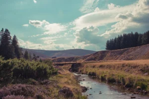
Discovering Ballater on a road trip and in a van: Complete Guide
Prepare your RoadTrip to Ballater with our complete guide. History, climate, budget, where to sleep, we cover everything so you can make the most of your trip to Ballater.
Read more
Our PS that adds nothing
On the way back to Edward after the walk from Duncansby Head, Caroline says to me, “Can you believe we’re further north than Moscow?” I check. Yes. John o’Groats is at 58.64° north latitude, Moscow at 55.75°. We spent 20 minutes trying to name cities even further north (Stockholm no, Helsinki yes by a little, Reykjavik much more). In the end, we just noted that we were above Copenhagen, which explained why we were cold in mid-August. There you go. PS that adds nothing.